
Maps

Creeks
The team is currently creating these maps and field checking the locations. percentages.
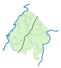
Streams feeding into Little Conewago Creek
Streams feeding into Codorus Creek
Understanding Stream Order Classification

Watersheds
UPCOMING!
Find your watershed! Type in your address to learn your watershed!
Land Use
The team is currently creating these maps and calculating the percentages.
Thus, with about x% of the Township mapped as of January 18, 2022, the maps are as follows. Updates will continually occur at least until 100% is reached. Therefore, please check the date on the map when using these numbers as the data is subject to change - perhaps dramatically so!
Forested Land
Impervious
Roads
Sidewalks
Buildings
Farm Fields
Park Maps
Did you know that the Township has eight parks? The "conservation resources" vary widely but they are open space nonetheless.
Cousler Park - 110.4 acres (map and info)
Greg A. Crist Memorial Park 23.08 acres (map and info)
Stillmeadow Park - 17.60 acres (map and info)
Eagles View Park - 10.92 acres (map and info)
Ridings Recreation Area - 5 acres (map and info)
Emigsville Park - 5.20 acres (map and info)
Johnston Park - 4 acres (map and info)
Nittany Park - 1.7 acres (map and info)
Mountain View Park - 1.3 acres (map and info)
Non Park Open Space
HOA outlots
Conservation Easements
Storm Water Infrastructure
Many of our waterways now begin with storm drains and storm water ponds.
Though mapped, the team is currently field checking all locations. x% have been varified so far.
Storm Drains throughout the Township
Founded 2021.
All rights reserved.