
Project Ideas
Storm Water Ponds
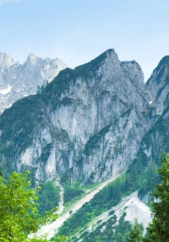
Planting of Trees
Removal of Invasive Plant Species
Creation of Pollinator Meadows
Projected Potential Project Partners:
Manchester Township
Central York School District
HOA Open Space
Individual Landowners
Projects
GIS layers
At the moment the Society's time is heavily spent in creating, editing, and ground truthing data which is then inputted into Arcmap. Hopefully, this will allow interested parties and decision makers to have the information they need in order to plan appropriately, and to make informed decisions about our natural areas.
Streams Land Use
Storm Water Ponds Storm Drains
Storm Lines
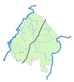
Stream Layer.
The base layer was pulled from York County's GIS portal. The layer needs a lot of cleaning up! For example many of the layer's stream lines are not in correct channels. We are correcting this. Also, many small order streams do not even appear on the layer at all! We are correcting this. There are also many duplicate sections of streams (especially where they are culverted under roads). We are correcting this.
New Layer - Land Use
The team is currently digitizing the existing various land uses throughout the township. Begun in November of 2019, the layer is about 30% complete. The purpose of this layer is to be able to calculate data like total impervious surfaces (roads, sidewalks, and buildings) or the amount of forest and farm fields in the township. Right now there is no comprehensive way to do this. We are correcting this. Eventually this work will be expanded to include the portions of surrounding governmental entities that drain into streams of the township (i.e. Springettsbury, East Manchester, Conewago, Dover, and West Manchester Townships, The City of York, and North York Boro).
New Layer - Storm Water Ponds
No townshipwide or countywide storm water pond layer exists in any sense. We are correcting this. A layer is being developed to show not only location but size and quality of the habitat found.
New Layer - Storm Drains
New Layer - Storm Line Systems
0
Trees Planted
1.5
Hours of Invasive Plants Removed
0
Pollinator Habitats Created

Invasive Species Removal
Multiple slopes, equipment to rent
One and a half hours of work spent by volunteers removing invasives throughout the Township!

Impacts
Trees Planted - 0
Hours of Invasive Removal - 1
More information available with our staff
Don't hesitate to reach out to our staff if you need any information.
ugh
Founded 2021.
All rights reserved.